
Documents - Maps
Showing 1-14 of 14 items
| ID | Thumbnail | Title | Description | Year | Keywords/Links |
|---|---|---|---|---|---|
| Pre-1841 (5 of 6) [Show All] | |||||
| 185 |
|
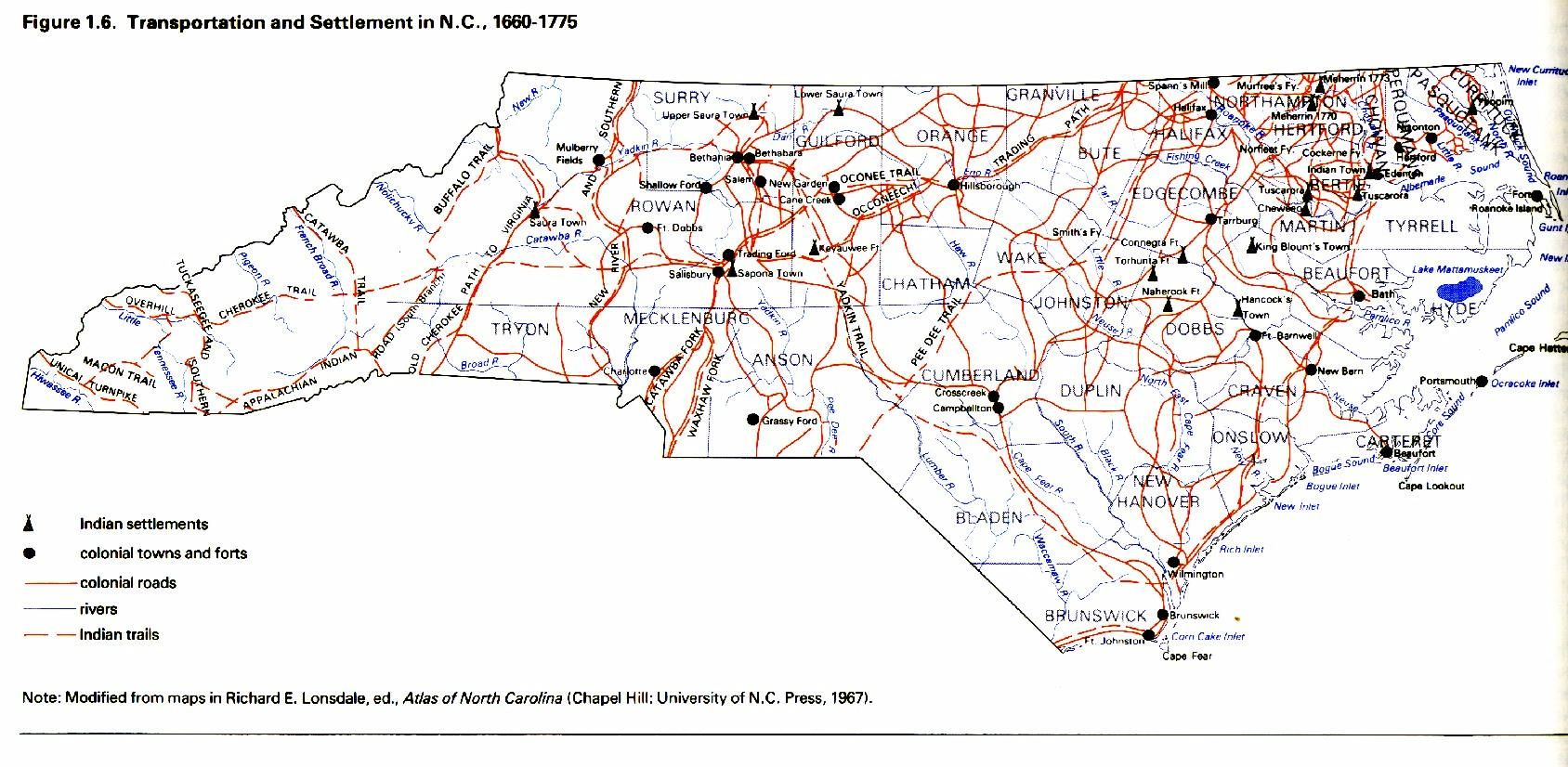
1660-1775 Settlement routes in NC | 1660-1775 Map showing the different settlement routes in NC. Indian settlements and other settlements are shown.
|
Document: Maps | |
| 182 |
|
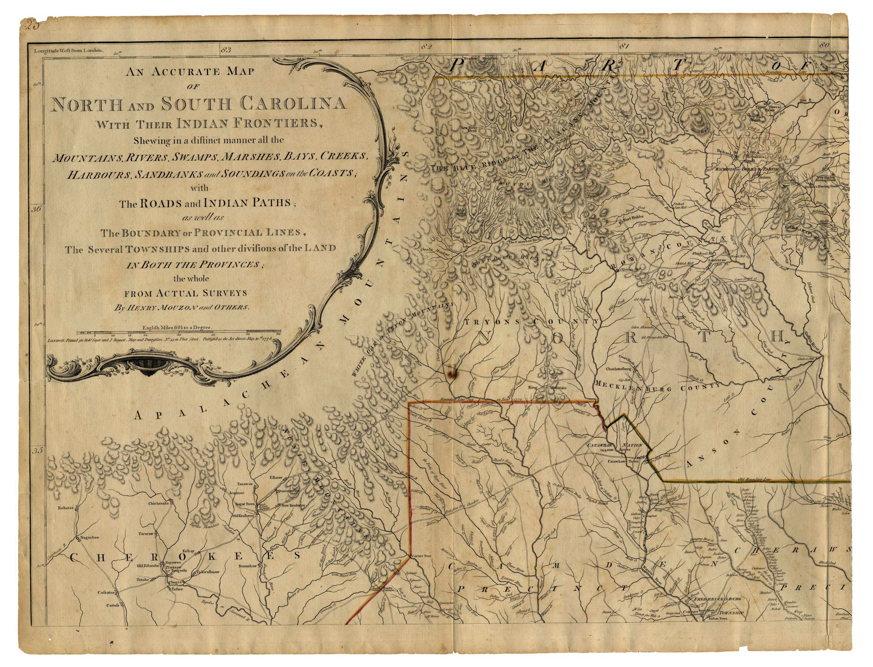
1775 Henry Mouzon Map | 1775 map showing roads, Indian paths and several townships and other divisions of land.
|
1775 | Document: Maps |
| 63 |
|
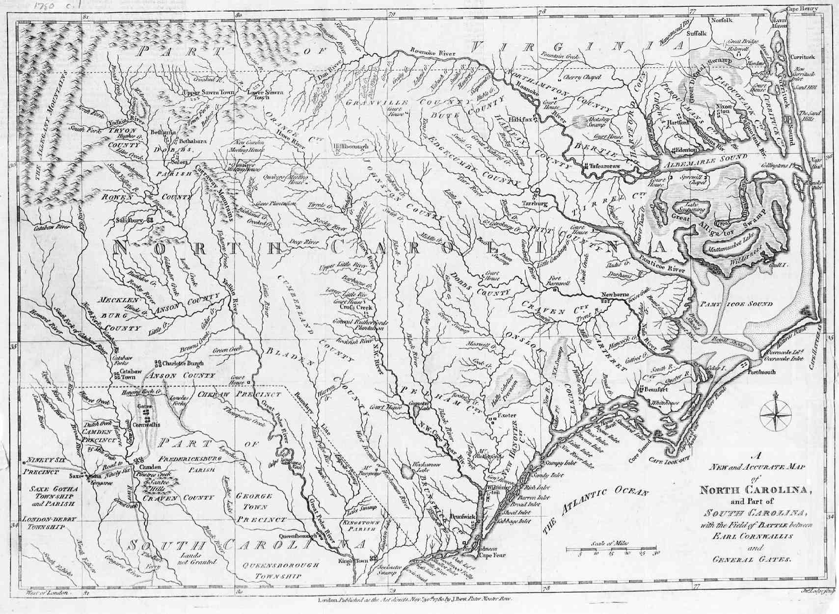
1780 Map of North Carolina | A New and accurate map of North Carolina and part of South Carolina with the field of battle between Earl Cornwallis and General Gates.
|
1780 | Document: Maps, Map |
| 255 |
|
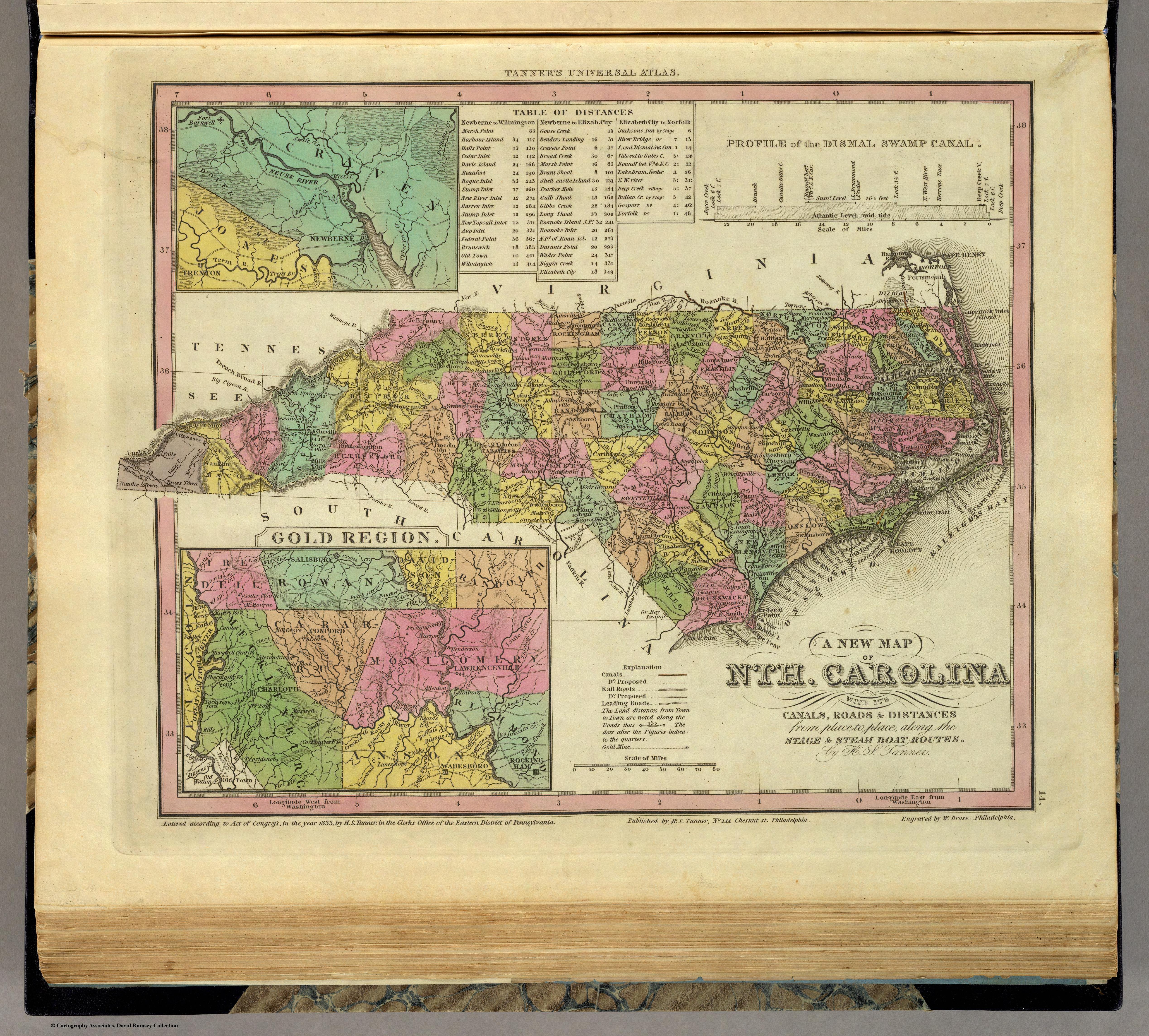
1836 Tanner North Caronia Map | A New Map Of Nth. Carolina With Its Canals, Roads & Distances from place to place, along the Stage & Steam Boat Routes. by H.S. Tanner.
|
1836 | Document: Maps, map, Tanner |
| 676 |
|
Avenues of Early Settlement | Map showing paths of settlement by different groups
|
Document: Maps, Map, settlement, German, Scott-Irish | |
| 1861-1874 | |||||
| 177 |
|
1868 Map of Cleveland County | 1868 Map of Cleveland County
|
1868 | Document: Maps, map |
| 1875-1899 | |||||
| 186 |
|
1895 Map of North Carolina | 1895 Map of North Carolina by Rand, McNally & Co.
|
1895 | Document: Maps, map |
| 677 |
|
Kyzer 1886 Cleveland County Taxpayers | Detailed map of Cleveland County taxpayers showing where they lived. A large map with a lot of valuable information.
|
Document: Maps, Kyzer, taxpayers | |
| 6 |

|
Sanborn Maps For Shelby | Sanborn Maps for Shelby North Carolina from 1885 to 1921
|
Town: Shelby, Document: Maps, Sanborn, | |
| 1900-1930 | |||||
| 178 |
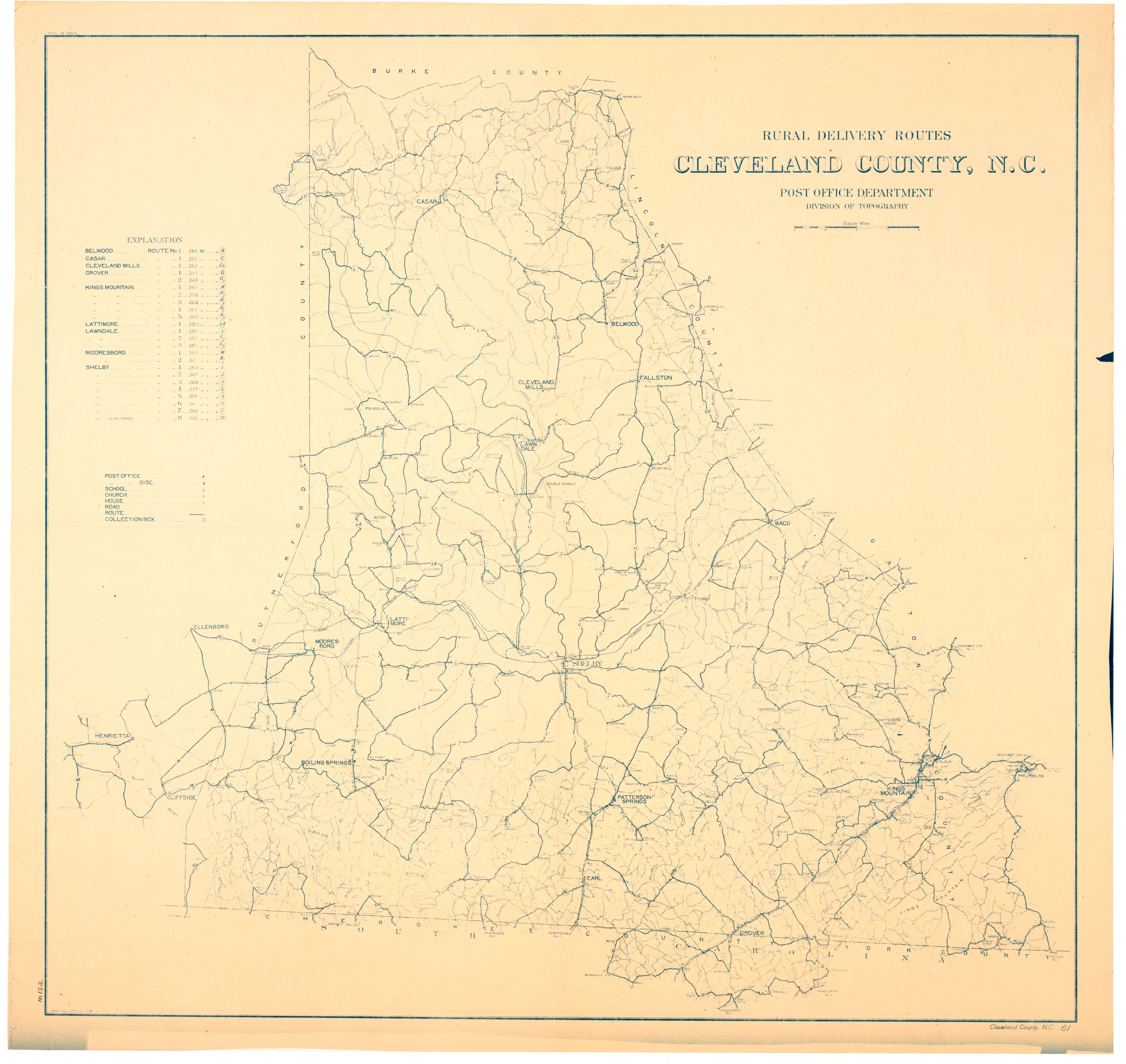
|
1912 Rural delivery routes in Cleveland County | 1912 Rural delivery routes in Cleveland County
|
1912 | Document: Maps, map, |
| 179 |
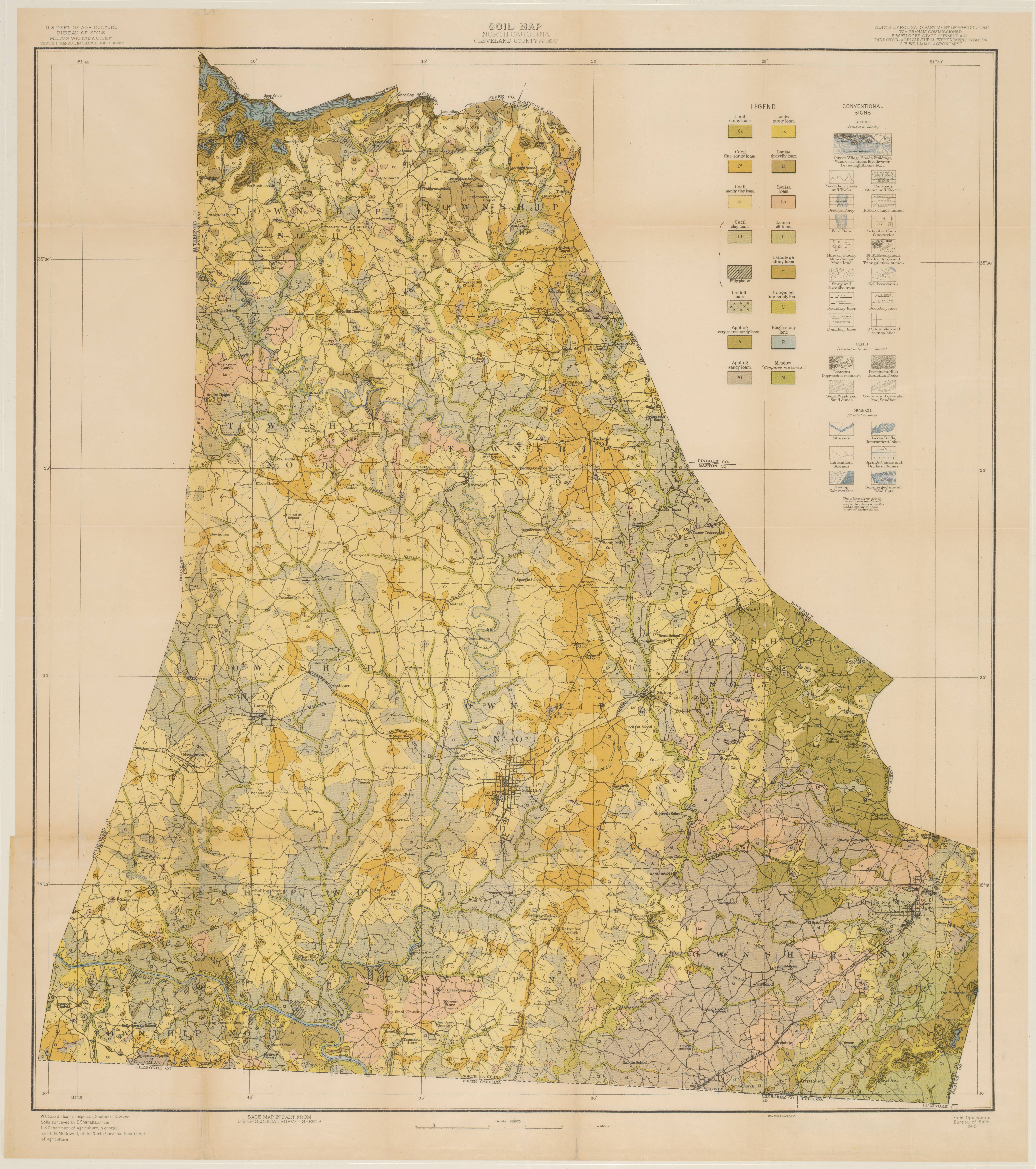
|
1916 Soil Survey of Cleveland County | 1916 Soil Survey of Cleveland County. Old communities are shown as well of other valuable information
|
1916 | Document: Maps, map |
| 180 |
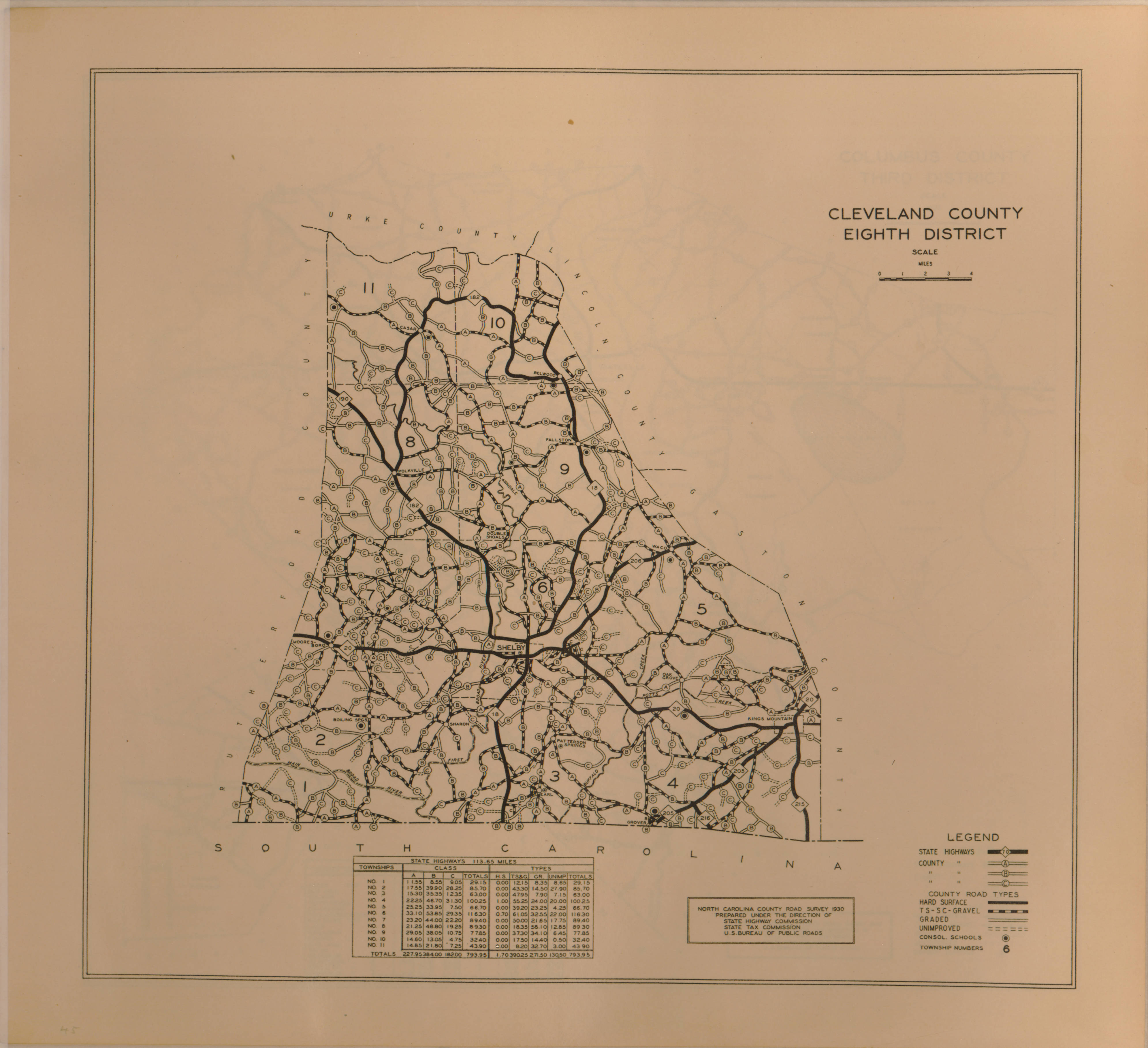
|
1930 Road Survey of Cleveland County | 1930 Road Survey of Cleveland County.
|
1930 | Document: Maps, map |
| 6 |
|
Sanborn Maps For Shelby | Sanborn Maps for Shelby North Carolina from 1885 to 1921
|
Town: Shelby, Document: Maps, Sanborn, | |
| General Historical | |||||
| 187 |
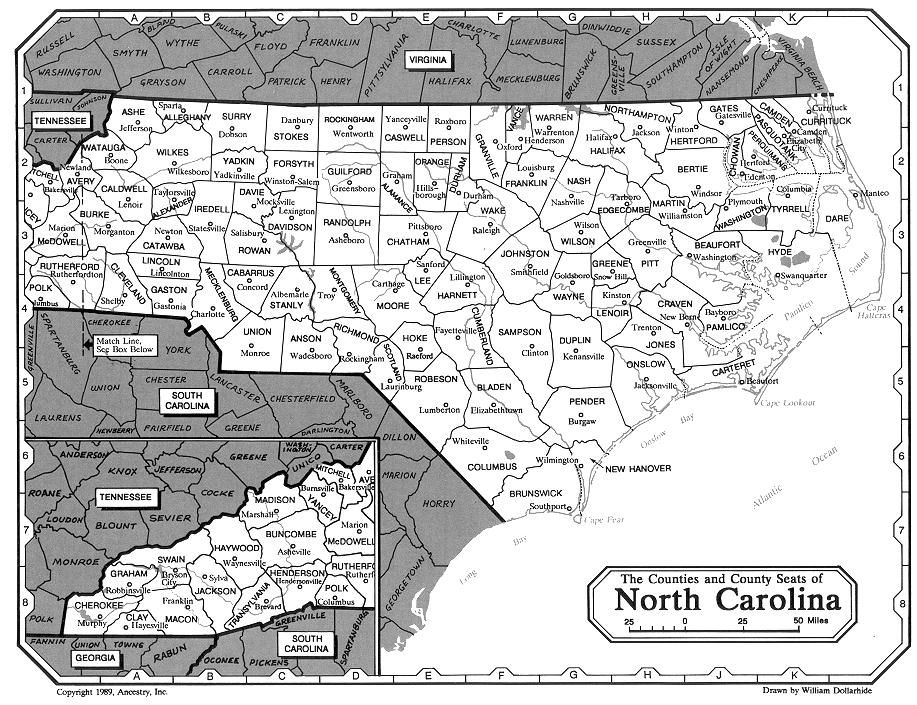
|
North Carolina County Seats | North Carolina County Seats
|
Document: Maps, map | |